The Atlas Mountains are one of the most significant mountain systems in Africa, stretching across the northwestern part of the continent. Extending through Morocco, Algeria, and Tunisia, this vast mountain range serves as a natural barrier between the Mediterranean coast and the Sahara Desert.
Understanding the Atlas Mountains map helps travelers, geographers, students, and researchers visualize the range’s location, elevation patterns, and regional importance.
Geographic Location of the Atlas Mountains
The Atlas Mountains map spans approximately 2,500 kilometers (1,550 miles) across North Africa. The range begins in southwestern Morocco near the Atlantic Ocean and continues eastward through northern Algeria before reaching Tunisia. These mountains form a complex network of peaks, plateaus, valleys, and ridges that influence climate, biodiversity, and human settlement throughout the region.
On a map, the range appears as a broad arc running parallel to the Mediterranean coastline. While often considered a single mountain chain, the Atlas Mountains consist of several distinct subranges, each with unique geological and environmental characteristics. The mountains separate fertile coastal regions from the arid landscapes of the Sahara, making them an important geographical feature.
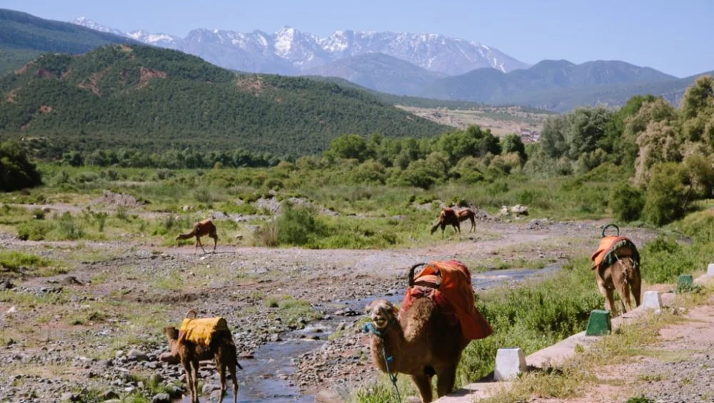
Morocco contains the largest and highest sections of the range, while Algeria hosts extensive mountain systems that contribute significantly to the country’s terrain. Tunisia contains the easternmost extensions, where the mountains gradually decrease in elevation before merging into lower hills and plains.
Major Subranges Visible on the Atlas Mountains Map
The mountain system is divided into several major sections that can be identified on regional maps.
High Atlas
The High Atlas is the most prominent and highest section of the range. Located in central Morocco, it contains many of North Africa’s tallest peaks. This subrange stretches from the Atlantic coast toward eastern Morocco and features dramatic landscapes with steep slopes and deep valleys.
Middle Atlas
Situated north of the High Atlas, the Middle Atlas consists of rolling mountains, forests, and plateaus. This area receives more rainfall than many surrounding regions, supporting diverse vegetation and wildlife. The range plays an important role in Morocco’s water resources.
Anti-Atlas
The Anti-Atlas lies south of the High Atlas and extends toward the Sahara Desert. It is generally older and lower in elevation than the High Atlas. The rugged terrain includes rocky plateaus and scenic desert landscapes.
Tell Atlas
The Tell Atlas extends across northern Algeria and into Tunisia. Positioned near the Mediterranean coast, this subrange experiences a relatively mild climate. Fertile valleys and agricultural areas are common throughout the region.
Saharan Atlas
Located farther south in Algeria, the Saharan Atlas forms a transitional zone between the northern mountains and the Sahara Desert. The range contributes to the region’s unique environmental conditions and serves as an important watershed.
Elevation and Highest Peaks
Elevation is one of the defining characteristics of the Atlas Mountains. The highest peaks are concentrated primarily within Morocco’s High Atlas region.
The tallest mountain in the range is Mount Toubkal, which reaches an elevation of approximately 4,167 meters (13,671 feet) above sea level. Mount Toubkal is also the highest peak in North Africa and attracts thousands of hikers and climbers every year.
Several other notable peaks contribute to the impressive elevation profile of the range, including:
· Ouanoukrim: About 4,089 meters (13,415 feet)
· M'Goun: Around 4,071 meters (13,356 feet)
· Jebel Ayachi: Approximately 3,757 meters (12,326 feet)
The elevation gradually decreases eastward through Algeria and Tunisia. Despite this decline, many areas still feature rugged terrain and significant mountain landscapes that influence local climates and ecosystems.
Geological Formation
The Atlas Mountains have a fascinating geological history that spans millions of years. Unlike many mountain systems formed by direct continental collisions, the Atlas range developed through a combination of tectonic activity, uplift, and volcanic processes.
Geologists believe much of the range formed during the Alpine orogeny, a period of mountain building that also created several major European mountain systems. Compression and faulting caused sections of the Earth's crust to rise, resulting in the peaks and ridges visible today.
The region contains diverse rock formations, including limestone, sandstone, shale, and volcanic rocks. This geological diversity contributes to the varied landscapes seen across the mountain system.
Climate and Environmental Influence
The Atlas Mountains significantly affect weather patterns throughout North Africa. Acting as a natural barrier, they intercept moisture from the Atlantic Ocean and Mediterranean Sea.
The northern slopes typically receive higher levels of precipitation, supporting forests, grasslands, and agricultural activities. In contrast, the southern slopes experience much drier conditions as they transition toward the Sahara Desert.
Snowfall is common at higher elevations during winter, particularly in the High Atlas. Some peaks remain snow-covered for several months, creating a striking contrast with the desert landscapes to the south.
The mountains also serve as an important source of freshwater. Rivers originating in the range provide water for cities, farms, and rural communities across Morocco, Algeria, and Tunisia.
Biodiversity and Natural Habitats
The varied elevations and climates of the Atlas Mountains support a rich diversity of plant and animal species. Forests of cedar, oak, pine, and juniper can be found in many areas, especially within the Middle Atlas.
Wildlife includes Barbary macaques, wild boars, foxes, eagles, and numerous bird species. Some animals found in the region are considered rare or threatened due to habitat loss and environmental pressures.
Protected national parks and conservation areas help preserve these ecosystems while promoting sustainable tourism and environmental awareness.
Cultural and Economic Importance
For centuries, the Atlas Mountains have been home to diverse communities, including many Amazigh (Berber) populations. Traditional villages, terraced agriculture, and unique cultural practices remain important features of the region.
Agriculture plays a vital role in mountain communities, with crops such as olives, almonds, figs, and cereals cultivated in fertile valleys. Livestock farming is also common in higher elevations.
Tourism has become increasingly important in recent decades. Visitors are drawn by opportunities for hiking, trekking, skiing, cultural exploration, and scenic photography. Destinations such as Mount Toubkal and the surrounding valleys attract travelers from around the world.
Conclusion
An Atlas Mountains map reveals much more than a mountain range; it highlights one of Africa’s most important geographical features. Stretching across Morocco, Algeria, and Tunisia, the mountains shape climate patterns, support biodiversity, and provide essential resources for millions of people.
From the towering peaks of the High Atlas to the rolling landscapes of Tunisia, the range offers remarkable natural beauty and cultural significance. Understanding its location, elevation, and regional divisions provides valuable insight into the geography and environmental importance of North Africa.